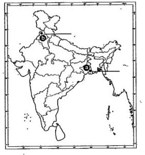
In the given political outline map of India locate and label the following with appropriate symbols:A. The state at the top in human development indexB. An oil refinery located in Uttar PradeshC. A major sea port located in OdishaD. Iron ore producing area in Karnataka with name E. Dry land farming areas with name
A- KeralaB-MathuraC- ParadwipD- Hills of Kudremukh in KarnatakaE- Gujarat or Rajasthan
Related Solutions
Locate and label the following with appropriate symbols on the same given outline political map of India
(i) Kandla - Major Sea Port
(ii) Bhilai - Iron and Steel Plant
(iii) Kaiga - Nuclear Power Plant
View SolutionOn the given political outline map of India locate and label the following features with appropriate symbols :
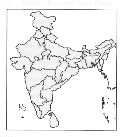
A. Narora - Nuclear Power Plant .
(ii) Tuticorin - Major Sea Port.
(iii) C. Bhilai - Iron and Steel Plant.
View SolutionThe following features are to be located and labelled on the given India political outline map: (a) Cotton textile industry-Moradabad (b) Nuclear Power Plant-Rawatbhata Identify the features marked on the same given India political map and write their namnes: (c) A Major Cotton Producing Area (d) A Software Technology Park (a) Name the place related to the calling off the Non-Cooperation Movement. (b) Where was the Indian National Congress Session held in December 1920? (c) In which state is Digboi oil field located? (d) Name the state where Bhilai Iron and Steel Plant is located. (e) Name the Southernmost major sea port located on the eastern coast of India,
View SolutionOn the given political outline map of india locate and label the following with appropriate symbols : A. Oil field - digboi B. Iron and steel plant - bhilai C. Major sea prot - kochi
View SolutionLocate and label the following on the given political map of India with appropriate symbols.
The State having largest area.
View Solution(A) Locate and label the place on the given outline political map of India:
(a) The place where the Jallianwala Bagh Massacre took place.
(b) The place where the Indian National Congress Session was held in 1927
B. The following features are to be located and labelled on the given India political outline map :
(a) Kandla - Major Sea port
(b) Hirakud Dam
Identify the features marked on the same given India political map and write their names :
(c ) A type of Soil
(d) Iron Ore Mine
View SolutionOn the given political outline map of India locate and label the following with appropraite symbols. A. Salem-Iron and Steel Centre. B. Kandla -Major Sea Port. C. Hyderabad-Software Technology Park.
View Solution(A) Locate and label the place on the given outline political map of India:
(a) The place where the Indian National Congress Session was held in December, 1920. 1
(b) The place where 22 policemen were burnt forcing Gandhiji to call off the Non cooperation Movement.
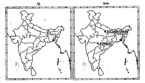
(B) The following features are to be located and labelled on the given India political outline map:
(a) Bhadrawati – Iron and Steel Plant
(b) Beawar-Mica Mine
Identify the features marked on the same given India political map and write their, names:
(c) Nuclear Power Plant
(d) Major Sea Port
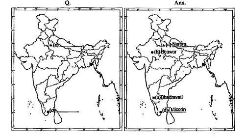
(a) Name the place where the Indian National Congress session was held in December, 1920.
(b) Name the place where 22 policemen were burnt forcing Gandhiji to call off the Non-cooperation Movement.
(c) Name the nuclear plant located in Uttar Pradesh. (d) Name the iron and steel plant located in Chhattisgarh. (e) Which is the southernmost sea port of India?
View SolutionLocate and label the following on the political map of India with appropriate symbols.
(i) Tea producing states
(ii) Coffee producing states
View SolutionLocate and label the following on the political map of India with appropriate symbols.
(i) Rice producing states (ii) Wheat producing states
View SolutionOn the given Political outline map of India, locate and label the following with appropriate symbols. (i) Vijayanagara : The imperial capital of Krishnadeva Raya.
View SolutionLocate and label any three of the following with appropriate symbols on the game given outline political map of India.
View SolutionLocate and label ten flood prone areas on an outline map of india
View SolutionLocate and label earthquake prone areas on an outline map of india .
View SolutionLocate and label drought prone areas on an outline map of india .
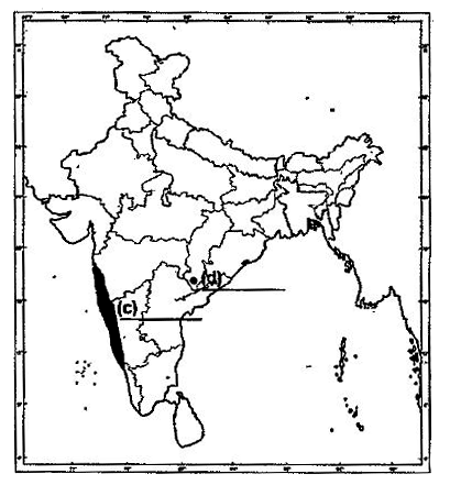
View SolutionThe following features are to be located and labelled on the given India political outline map: a. Paradip -A major sea port b. Tungabhadra Dam Identify the features marked on the same given India political map and write their names: c. A Type of Soil d. Mica Mine
View SolutionThe following features are to be located are labelled on the given India political outline map:
(a) Ramagundam- Thermal power plant
Mohali -Software technology park
Identify the features marked on the same given India political map amd write their names:
Major producer state of sugarcane
(d) An oil field
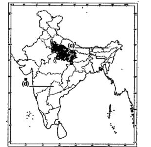
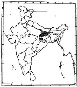
View SolutionThe following features are to be located and labelled on the given India political outline map :
(a) Gandhinagar - Software Technology Park
(b) Bokaro - Iron and Steel Plant
Identify the features marked on the same given India political map and write their names :
(c) Terminal station of North - South Corridor
(d) Major Rice Producing State
View SolutionMost of Indian's oil refineries are located near sea port because
View SolutionName the state where Paradeep Sea Port is located.
View Solution