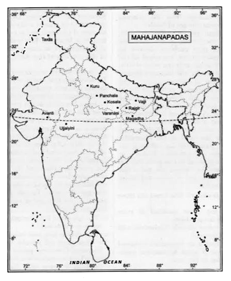
On the given political outline map of India, locate and label the Mahajanapada and cities.
(a) Vajji (b) Magadha (c) Kosala, (d) Kuru,
(e) Panchala (f) Gandhara (g) Avanti,
(h) Rajgiri, (i) Ujjaiyini, (j) Taxila, (k) Varanasi
Topper's Solved these Questions
- KINGS, FARMERS AND TOWNSBOOK - FULL MARKSCHAPTER - KINGS, FARMERS AND TOWNSEXERCISE - ADDITIONAL QUESTIONS SOLVED (Project Work)
12 Videos
- KINGS, FARMERS AND TOWNSBOOK - FULL MARKSCHAPTER - KINGS, FARMERS AND TOWNSEXERCISE - ADDITIONAL QUESTIONS SOLVED (Source Based Questions )
9 Videos
- KINGS AND CHRONICLES THE MUGHAL COURTS BOOK - FULL MARKSCHAPTER - KINGS AND CHRONICLES THE MUGHAL COURTS EXERCISE - Test Your Skill
5 Videos
- KINSHIP, CASTE AND CLASS EARLY SOCIETIES BOOK - FULL MARKSCHAPTER - KINSHIP, CASTE AND CLASS EARLY SOCIETIES EXERCISE - PREVIOUS YEARS BOARD QUESTIONS SOLVED
29 Videos
Similar Questions
On the given political outline map of India mark and name the following: (a) Kuru (b) Rajgir (c) Magadha (d) Avanti (e) Ujjain
View SolutionOn the given political outline map locate and label the important kingdoms
(a) Kushanas, (b) Shakas, (c) Satavahanas, (d) Vakatakas, (e) Gupta
View SolutionOn the given political outline map locate and label the important cities/towns of ancient India.
Mathura, (b) Kanauj, (c) Puhar, (d) Bharukachchha, (e) Shravasti, (f) Vaishali, (g) Vidisha
View SolutionOn the given political outline map of India, mark and nar ne the following: (a) Golconda (b) Vijayanagar (c) Mysore (d) Quilon (e) Tirunelveli
View SolutionOn the given political outline map locate and label the places where Ashokan inscriptions, rock edicts are situated.
(a) Sanchi, (b) Topara, (c) Meerut pillar (d) Kaushambia
View SolutionOn the given political outline map of india locate and label the following with appropriate symbols :
A. Oil field - digboi
B. Iron and steel plant - bhilai
C. Major sea prot - kochi
View SolutionThe the given political outline map of india locate and label the following with appropiate symbols .
A. Ankleshwar - Oil field
B. Durgapur - Iron and steel plant .
C. Tuticorin - Major seaport
View SolutionOn the given political outline map of India locate and label the following with appropraite symbols.
A. Salem-Iron and Steel Centre.
B. Kandla -Major Sea Port.
C. Hyderabad-Software Technology Park.
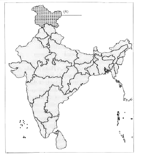
View Solution(a) One item A is shown in the given political outline map of India. Identify this item with the help of following information and write its correct name on the line marked on the map.
(A) A Type of Soil
(ii) On the same political outline map of India, locate and label the following items with appropriate symbols.
(B) Sariska Wildlife Sanctuary
(C) Salal Dam
(30.3) In which State is Salal dam located?

View Solution(a) One feature A is shown in the given political outline map of India. Identify this feature with the help of the following information and write its correct name on the line marked on the map: (A) A soil type
(b) On the same political outline map of India, locate and label the following features with appropriate symbols: (B) Bhakra Nangal Dam (C) A State which is the major producer of Cotton
View Solution

