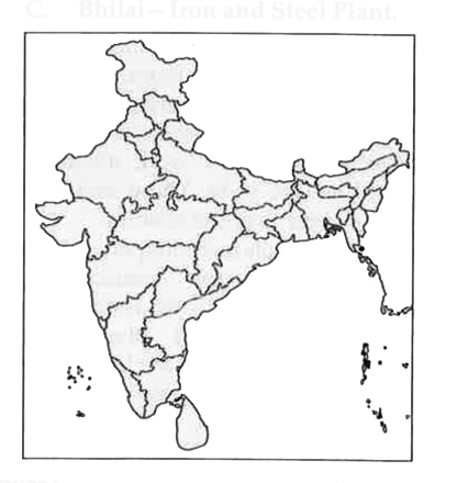
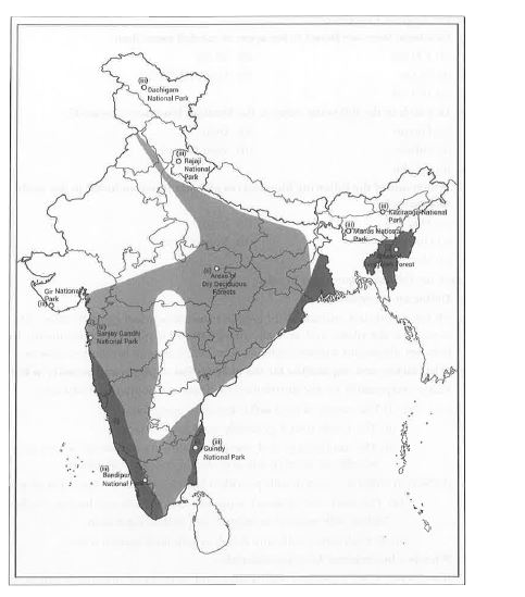
On the given outline map of India, label the following.
(i) Areas of Evergreen Forests.
(ii) Area of Dry Deciduous Forests.
(iii) Two National Parks each in Northern, Southern, Eastern and Western parts of the country.
Topper's Solved these Questions
- NATURAL VEGETATION AND WILDLIFE BOOK - VK GLOBAL PUBLICATIONCHAPTER - NATURAL VEGETATION AND WILDLIFE EXERCISE - NCERT Corner (Answers to NCERT questions)
13 Videos
- NATURAL VEGETATION AND WILDLIFE BOOK - VK GLOBAL PUBLICATIONCHAPTER - NATURAL VEGETATION AND WILDLIFE EXERCISE - NCERT Corner (Source-based Question)
3 Videos
- NATURAL VEGETATION AND WILDLIFE BOOK - VK GLOBAL PUBLICATIONCHAPTER - NATURAL VEGETATION AND WILDLIFE EXERCISE - HOTS [Higher Order Thinking Skills]
4 Videos
- INDIA SIZE AND LOCATION BOOK - VK GLOBAL PUBLICATIONCHAPTER - INDIA SIZE AND LOCATION EXERCISE - NCERT CORNER (SOURCE-BASED QUESTION) (Read the sources given below and answer the questions that follows)
3 Videos
- PHYSICAL FEATURES OF INDIABOOK - VK GLOBAL PUBLICATIONCHAPTER - PHYSICAL FEATURES OF INDIAEXERCISE - NCERT Corner ( Answer to NCERT Questions )(Source based Question )
3 Videos
Similar Questions
Knowledge Check
In India, in which one of the following areas are the tropical evergreen forests found ?
AThe Western GhatsBThe Eastern GhatsCThe Western HimalayaDThe Central Himalaya
On an outline map of India, mark and label the following :
(i) Areas having Mangrove forests.
(ii) Biosphere reserves of Nanda Devi, Sunderbans, Gulf of Mannar and Nilgiri.
(iii) Mark the location of Forest Survey of India Head Quarter.
View SolutionOn the given outline political map of India locate the following:
(i) A neighbouring country lying in the Arabian Sea.
(ii) Myanmar
(iii) An Indian state sharing border with China.
View SolutionOn the given Political outline map of India, locate and label the following with appropriate symbols.
(i) Vijayanagara : The imperial capital of Krishnadeva Raya.
View SolutionOn the given outline map of India, identify and mark the following:
(i) Most populations state.
(ii) State having highest density of population.
(iii) State having lowest density of population.
View SolutionOn an outline map of India, mark the areas covered by the following soil categories.
(i) Red Soil
(ii) Laterite soil
(iii) Alluvial soil.
View SolutionOn the given political outline map of India locate and label the following features with appropriate symbols :
A. Narora - Nuclear Power Plant .
(ii) Tuticorin - Major Sea Port.
(iii) C. Bhilai - Iron and Steel Plant.

View SolutionOn the given map of Britain, mark and locate the following iron and coal manufacturing areas.
(i) Leeds
(ii) Shefficld
(iii) Liverpool
(iv) Bristol
(v) Swansea
View Solution

