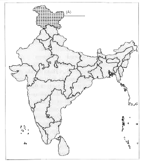
To which Lodi Sultan does the given map relate and what town lies the side marked A on the map represent?
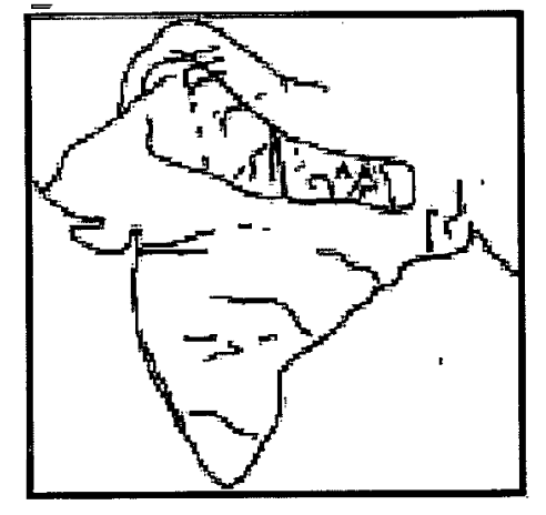
Bahlul Lodi,Jaunpur
Sikandar Lodi, Aligarh
Ibrahim Lodi, Jaunpur
Ibrahim Lodi, Aligarh
The correct Answer is:A
Similar Questions
Knowledge Check
The shaded area is the given outline map of India represents
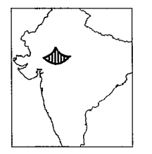 AChhotanagpur plateauBMahadeo HillsCMalwa PlateauDDeccan Trap
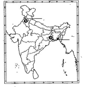
Two features (a) and (b) are marked on the given political outline map of India. Identify these features with the help of the following information and write their correct names on the lines marked on the map
(i) The place where the Indian National Congress Session was held
(ii) The city where 'Jallianwalla Bagh' incidence took place
View Solution(a) One feature A is shown in the given political outline map of India. Identify this feature with the help of the following information and write its correct name on the line marked on the map: (A) A soil type
(b) On the same political outline map of India, locate and label the following features with appropriate symbols: (B) Bhakra Nangal Dam (C) A State which is the major producer of Cotton
View SolutionTwo features A and N are marked on the given political outline map of india identify these features with the help of the following information and write their correct names of the lines marked in the map:
B.Terminal station of East-west corridor
On the same political outline map of India,locate and label the following:
Vishakhapatnam-software Technology Park.
View Solution(a) One item A is shown in the given political outline map of India. Identify this item with the help of following information and write its correct name on the line marked on the map.
(A) A Type of Soil
(ii) On the same political outline map of India, locate and label the following items with appropriate symbols.
(B) Sariska Wildlife Sanctuary
(C) Salal Dam
(30.3) In which State is Salal dam located?
View SolutionThe scale of a map is 1:4000000. What is the actual distance between the two towns if they are 5 cm apart on the map?
View SolutionThe scale of a map is 1:4000000. What is the actual distance between the two towns if they are 5 cm apart on the map?
View SolutionThe scale of a map is 1:3000000. what is the actual distance between the two towns, if they are 3 cm apart on the map?
View Solution

