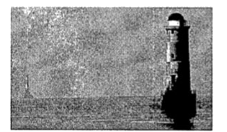
Case Study-1 : Trigonometry in the form of triangulation forms the basis of navigation, whether it is by land, sea or air. GPS a radio navigation system helps to locate our position on earth with the help of satellites.
A guard, stationed at the top of a 240 m tower, observed an unidentified boat coming towards it. A clinometer or inclinometer is an instrument used for measuring angles or slopes (tilt). The guard used the clinometer to measure the angle of depression of the boat coming towards the lighthouse and found it to be 30∘

(Lighthouse of Mumbai Harbour. Picture credit - Times of India Travel)
Make a labelled figure on the basis of the given information and calculate the distance of the boat from the foot of the observation tower.
The correct Answer is:240√3m
Topper's Solved these Questions
- SAMPLE QUESTION PAPERBOOK - OSWAL PUBLICATIONCHAPTER - SAMPLE QUESTION PAPEREXERCISE - Section - B
5 Videos
- SAMPLE PAPER 7BOOK - OSWAL PUBLICATIONCHAPTER - SAMPLE PAPER 7EXERCISE - Section -C
7 Videos
- SOME APPLICATIONS OF TRIGONOMETRY (HEIGHTS AND DISTANCES) BOOK - OSWAL PUBLICATIONCHAPTER - SOME APPLICATIONS OF TRIGONOMETRY (HEIGHTS AND DISTANCES) EXERCISE - CASE-BASED MCQs
15 Videos
Similar Questions
A guard observes an enemy boat, from an observation tower at a height of 180 m above sea level, to be at an angle of depression of 29∘
Calculate, to the nearest metre, the distance of the boat from the foot of the observation tower.
View SolutionForm the top of a light house 60 m high with its base at the sea-level the angle of depression of a boat is 15∘. Find the distance of the boat from the foot of light house.
View Solution
Knowledge Check
From the top of a cliff 50 m high, the angles of depression of the top and bottom of a tower are observed to be 30∘ and 45∘. The height of tower is
A50mB50√3mC50(√3−1)mD50(1−√33)mSoil water ptential is measured with the help of the instrument called
AporometerBtensiometerCpaedometerDvacuum gaugeWhich one of the following helps the ships to navigate?
AArea where the warm ocean currents and cold currents meetBArea of ocean currentsCArea of high tidesDArea of low tides
From the top of a lighthouse 120 m above the sea, the angle of depression of a boat is 15∘. what is the distance of the boat from the lighthouse?
View SolutionFrom the top of a cliff 50m high, the angles of depression of the top and bottom of a tower are observed to be 30∘ and 45∘ The height of tower is
View SolutionFrom the top of a cliff 50m high, the angles of depression of the top and bottom of a tower are observed to be 30∘ and 45∘ The height of tower is
View SolutionFrom the top of a lighthouse 120m above the sea, the angle of depression of a boat is 15∘. What is the distance of the boat from the lighthouse?
View SolutionThe angle of elevation of the top of a tower form a point 20 m away from its base is 45∘. What is the height of the tower?
View Solution
