A ship is to reach a place of south of west. In which direction should it be steered if the declination at the place is west of north.
To solve the problem of determining the direction in which the ship should be steered, we can follow these steps:
Step 1: Understand the Directions
The ship needs to reach a destination that is 10 degrees south of west. This means if we visualize the compass:
- West is at 270 degrees.
- South of west means we move 10 degrees towards the south from the west direction.
Step 2: Draw the Compass Directions
We can draw a coordinate system:
- North (0 degrees)
- East (90 degrees)
- South (180 degrees)
- West (270 degrees)
From west (270 degrees), moving 10 degrees south means:
- The angle will be 270 + 10 = 280 degrees.
Step 3: Consider the Declination
The declination at the place is given as 18 degrees west of north. This means:
- The magnetic north is shifted 18 degrees towards the west from the true north.
Step 4: Calculate the Magnetic Direction
Since the declination is 18 degrees west of north, the magnetic north is at:
- 0 degrees (true north) - 18 degrees = 342 degrees (in terms of compass direction).
Step 5: Find the Angle Between the True Direction and Magnetic Direction
Now we need to find the angle that the ship must steer to reach the destination (280 degrees) considering the magnetic north (342 degrees).
Step 6: Calculate the Required Steering Angle
To find the angle to steer:
- We need to find the angle between the magnetic north and the desired direction:
Steering angle=342−280=62 degrees
Step 7: Determine the Final Direction
The ship should be steered at an angle of 62 degrees east of the magnetic north to reach the destination.
Final Answer
The ship should be steered 62 degrees east of magnetic north.
---
The ship needs to reach a destination that is 10 degrees south of west. This means if we visualize the compass:
- West is at 270 degrees.
- South of west means we move 10 degrees towards the south from the west direction.
We can draw a coordinate system:
- North (0 degrees)
- East (90 degrees)
- South (180 degrees)
- West (270 degrees)
- The angle will be 270 + 10 = 280 degrees.
The declination at the place is given as 18 degrees west of north. This means:
- The magnetic north is shifted 18 degrees towards the west from the true north.
Since the declination is 18 degrees west of north, the magnetic north is at:
- 0 degrees (true north) - 18 degrees = 342 degrees (in terms of compass direction).
Now we need to find the angle that the ship must steer to reach the destination (280 degrees) considering the magnetic north (342 degrees).
To find the angle to steer:
- We need to find the angle between the magnetic north and the desired direction:
Steering angle=342−280=62 degrees
The ship should be steered at an angle of 62 degrees east of the magnetic north to reach the destination.
The ship should be steered 62 degrees east of magnetic north.
Topper's Solved these Questions
- MAGNETISM AND MATTERBOOK - DC PANDEY ENGLISHCHAPTER - MAGNETISM AND MATTEREXERCISE - 5.1
15 Videos
- MAGNETISM AND MATTERBOOK - DC PANDEY ENGLISHCHAPTER - MAGNETISM AND MATTEREXERCISE - 5.2
15 Videos
- MAGNETICSBOOK - DC PANDEY ENGLISHCHAPTER - MAGNETICSEXERCISE - MCQ_TYPE
1 Videos
- MODERN PHYSICSBOOK - DC PANDEY ENGLISHCHAPTER - MODERN PHYSICSEXERCISE - Integer Type Questions
17 Videos
Similar Questions
A ship is to reach a place 20∘ south of west . In what direction should it be steered if angle of declination at the place is 16∘ west ?
View SolutionA ship is sailing due west according to Mariner's compass . If the declination at the place is 17∘ west , what should be direction of ship ?
View Solution
Knowledge Check
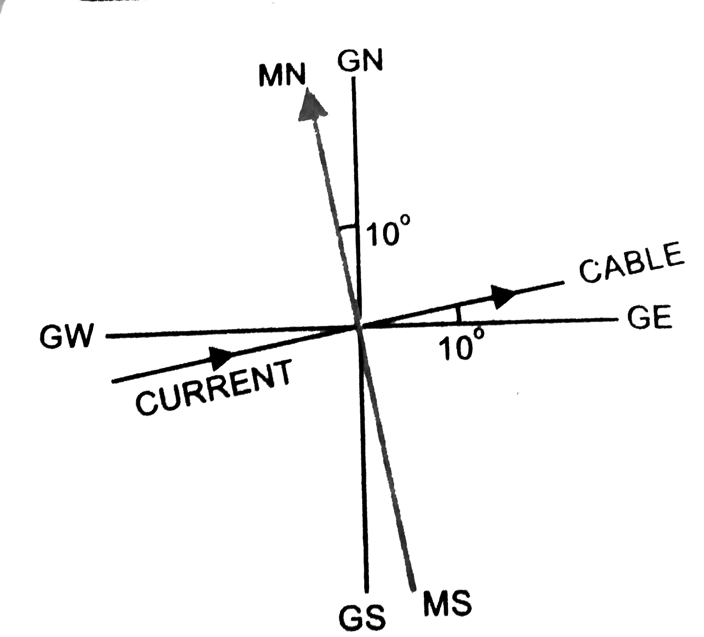
A long straight horizontal cable carries a current of 2.5amp. In the direction 10∘ south of west to 10∘ north of east, figure. The magnetic meridian of the place happens to be 10∘ west of the geographic meridian. The earth's magnetic field at the location is 0.33G and the angle of dip is zero. Locate the line of neutral points (Ignore the thickness of the cable). [At neutral points, magnetic fied due to a current cable is equal and opposite to the horizontal component of earth's magnetic field.]
 A15.15mmB30.15mmC35.15mmD40.15mm
A ship has to reach a palce which is due est form its present position . Declination at this point is 15∘. The direction form compass needle in which it should sail is .
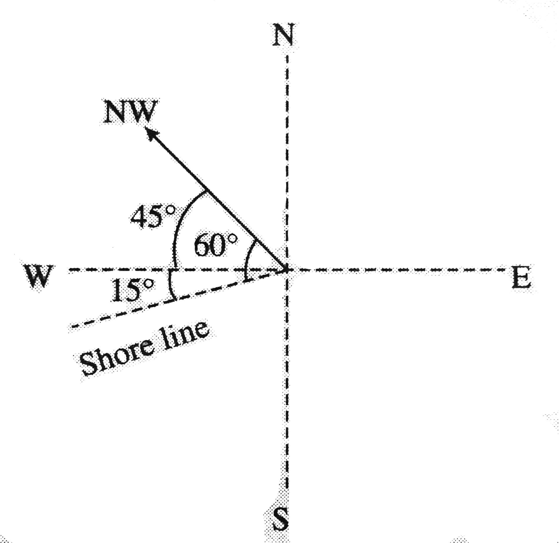
View SolutionA man rows a boat with a speed of 18Kmh−1 in the north-west direction (figure). The shoreline makes an angle of 15∘ south of west. Obtain the components of the velocity of the boat along the shoreline and perpendicular to the shoreline.

View SolutionThe horizontal component of the earth's magnetic field at a certain place is 3×10⁻⁵T and the direction of the field is from the geographic south to the geographic north. A very long straight conductor is carrying a steady current of 1 A. What is the force per unit length on it when it is placed on a horizontal table and the direction of the current is
(a) east to west,
(b) south to north?
View SolutionA horizontal straight conductor when placed along south-north direction falls under gravity, there is
View SolutionA ship is sailing due west according to mariner's compass . If the declination of the place is 20° east , then true direction of ship is
View SolutionYou are given a magnet. How will you use it to find north-south direction at a place ?
View Solution
