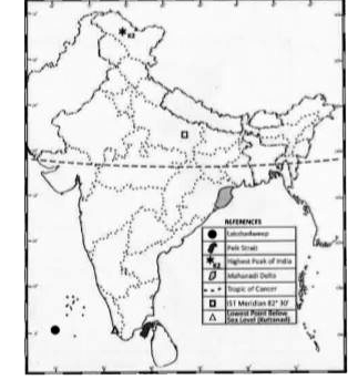
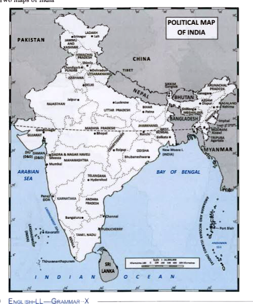
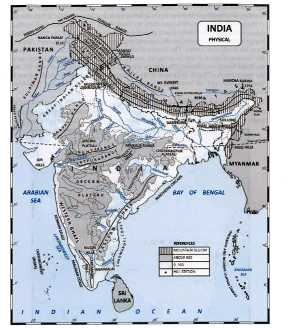
Locate on the political map of India:
Highest peak, Palk Strait, Mahandi Delta and Lowest point of India.
Text Solution
|
Updated on:21/07/2023
Topper's Solved these Questions
- BOOK - FULL MARKSCHAPTER - STRUCTURE AND PHYSIOGRAPHYEXERCISE - Additional Questions With Answers (V. Hots Questions)2videos
STRUCTURE AND PHYSIOGRAPHY
- BOOK - FULL MARKSCHAPTER - SOLAR RADIATION, HEAT BALANCE AND TEMPERATUREEXERCISE - ADDITIONAL QUESTIONS WITH ANSWER MAP SKILL1videos
SOLAR RADIATION, HEAT BALANCE AND TEMPERATURE
- BOOK - FULL MARKSCHAPTER - TOPOGRAPHICAL MAPSEXERCISE - ADDITIONAL QUESTIONS WITH ANSWERS (Viva Questions)5videos
TOPOGRAPHICAL MAPS
Similar Questions
Knowledge Check
- Question 1 - Select One
Highest peak in India is
AK2BEverestCNanda DeviDKanchanchanga
Locate on the political map of India:
Important hills stations.View SolutionLocate on the political map of India:
Coasts, Western and Eastern Ghats, Central Highlands, Desert, Island groups and Deccan plateaus.View SolutionWhat is the highest and lowest density of India?
View SolutionLocate on an outline map of India, Eastern jet stream.
View SolutionOn the outline map of India provided :
Mark and name the Palk StraitView SolutionLocate and label the following on the given political map of India with appropriate symbols.
State having highest density of population.View SolutionLocate on an outline map of India, isotherms in India in January and July.
View Solution


