Study the extract for topographical sheet 63K/12 shown in the figure given below and answer the following questions.
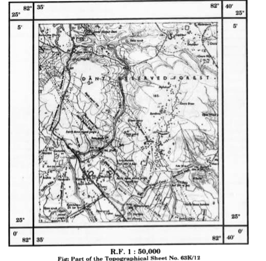
Give the height of the highest point on the map.
the map.
Topper's Solved these Questions
- TOPOGRAPHICAL MAPSBook:FULL MARKSChapter:TOPOGRAPHICAL MAPSExercise:ADDITIONAL QUESTIONS WITH ANSWERS (Multiple Choice Questions)
Explore 5 Videos
- TOPOGRAPHICAL MAPSBook:FULL MARKSChapter:TOPOGRAPHICAL MAPSExercise:ADDITIONAL QUESTIONS WITH ANSWERS (Very Short Answer Type Questions)
Explore 9 Videos
- TOPOGRAPHICAL MAPSBook:FULL MARKSChapter:TOPOGRAPHICAL MAPSExercise:EXERCISE (Exercise B)
Explore 8 Videos
- STRUCTURE AND PHYSIOGRAPHYBook:FULL MARKSChapter:STRUCTURE AND PHYSIOGRAPHYExercise:Additional Questions With Answers (VI. Map/Diagram Based Questions)
Explore 6 Videos
- WATER IN THE ATMOSPHEREBook:FULL MARKSChapter:WATER IN THE ATMOSPHEREExercise:(ADDITIONAL QUESTIONS WITH ANSWERS ) V HOTS Questions
Explore 2 Videos
Similar Questions
Study the extract for topographical sheet 63K/12 shown in the figure given below and answer the following questions.
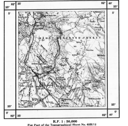
What is the direction of the flow of the Kuardari?
View SolutionStudy the extract for topographical sheet 63K/12 shown in the figure given below and answer the following questions.
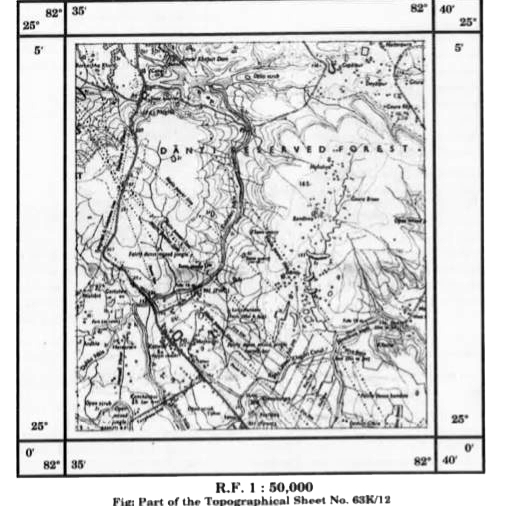
Name the two types of vegetation shown on part of the topographical sheet.
View SolutionStudy the extract for topographical sheet 63K/12 shown in the figure given below and answer the following questions.
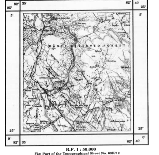
In which part of the sheet area is Lower Khajuri Dam located?
View SolutionStudy the extract for topographical sheet 63K/12 shown in the figure given below and answer the following questions.
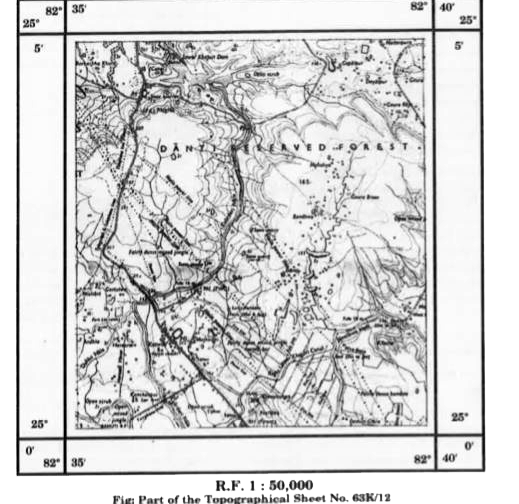
Which is the major settlement located in the east of the Kuardari Nala?
View SolutionStudy the extract for topographical sheet 63K/12 shown in the figure given below and answer the following questions.
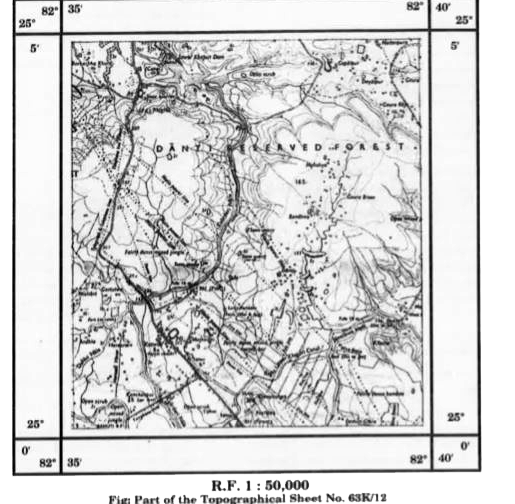
What type of settlement does this area have?
View SolutionStudy the extract for topographical sheet 63K/12 shown in the figure given below and answer the following questions.
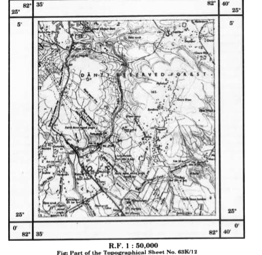
Name the geographical feature represented by white patches in the middle of Sipu Nadi.
View SolutionStudy the extract for topographical sheet 63K/12 shown in the figure given below and answer the following questions.
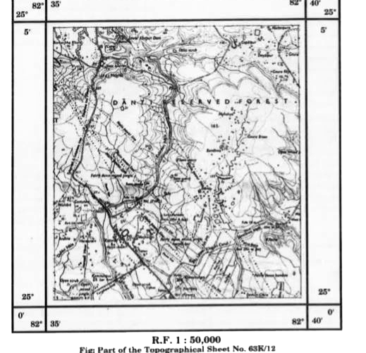
River Jamtihwa Nadi is flowing through which quarter of the map?
View SolutionStudy the extract from the topographical sheet No. 63K/12, as shown in the figure below and answer the following questions.
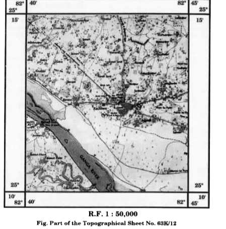
Name the major settlements of the area.
View SolutionStudy the extract from the topographical sheet No. 63K/12, as shown in the figure below and answer the following questions.
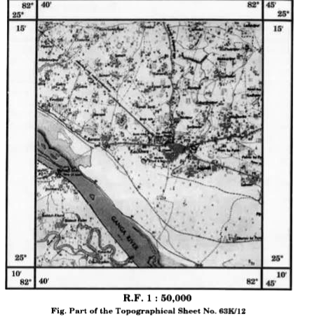
What is the direction of flow of the river Ganga?
View SolutionStudy the extract from the topographical sheet No. 63K/12, as shown in the figure below and answer the following questions.
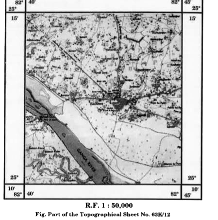
At which one of the banks of river Ganga, Bhatauli is located?
View Solution
