Explain about identification of cultural features from topographical sheets
Settlements, buildings, roads and railways are important cultural features shown on topographical sheets through conventional signs, symbols and colours. The location and pattern of distribution of different featw·es help in understanding the area shown on the map.
Types of Settlements: Four types of rural settlements may be identified on the map:
(i) Compact (ii) Scattered
(iii) Linear (iv) Circular
Urban centres are distinguished as:
(i) Cross-road town (ii) Nodal point
(iii) Market centre (iv) Hill station
(v) Coastal resort centre
(vi) Port
(vii) Manufacturing centre with suburban villages or satellite towns
(viii) Capital town (ix) Religious centre Site of settlements: It should be closely examined with reference to the contour and drainage map. Density of settlement is directly related to food supply. Sometimes, village settlements form alignments, i.e. they are spread along a river valley, road, embankment, coastline - these are called linear settlements. In the case of an urban settlement, a cross-road town assumes a fan-shaped pattern, the houses being arranged along the roadside and the crossing being at the heart of the town and the main market place. In a nodal town, the roads radiate in all directions. Transport and Communication Pattern: Relief, population, size and resource development pattern of an area directly influence the means of transport and communication and their density. These are depicted through conventional signs and symbols. Means of transport and communication provide useful information about the area shown on the map.
Topper's Solved these Questions
- TOPOGRAPHICAL MAPSBook:FULL MARKSChapter:TOPOGRAPHICAL MAPSExercise:ADDITIONAL QUESTIONS WITH ANSWERS (Viva Questions)
Explore 5 Videos
- TOPOGRAPHICAL MAPSBook:FULL MARKSChapter:TOPOGRAPHICAL MAPSExercise:ADDITIONAL QUESTIONS WITH ANSWERS (Short Answer Type Questions)
Explore 5 Videos
- STRUCTURE AND PHYSIOGRAPHYBook:FULL MARKSChapter:STRUCTURE AND PHYSIOGRAPHYExercise:Additional Questions With Answers (VI. Map/Diagram Based Questions)
Explore 6 Videos
- WATER IN THE ATMOSPHEREBook:FULL MARKSChapter:WATER IN THE ATMOSPHEREExercise:(ADDITIONAL QUESTIONS WITH ANSWERS ) V HOTS Questions
Explore 2 Videos
Similar Questions
If you are interpreting the cultural features from a topographical sheet, what information would you like to seek and how would you derive this information? Discuss with the help of suitable examples.
View SolutionExplain how do we interpret a topographical sheet?
View SolutionExplain in detail about cultural maps.
View SolutionExplain different types of settlements shown on a topographical sheet.
View SolutionHow are relief maps different from topographical maps?
View SolutionWrite short notes on
'Marginal Information' in Topographical sheets
View SolutionExplain about the features of peaty and humus soil.
View SolutionUnder which heads are topographical maps explained?
View SolutionExplain about the features of red and yellow soil.
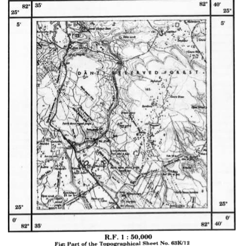
View SolutionStudy the extract for topographical sheet 63K/12 shown in the figure given below and answer the following questions.

Name the two types of vegetation shown on part of the topographical sheet.
View Solution
